- Home
- Nepal
- Adventure Activities
- Peak Climbing
- Mountain Expedition
- Local Tours
- Sirubari Village Homestay
- Ghale Gaun
- Kalinchowk Tour
- Halesi Mahadev - Maratika Cave package
- Chitwan Jungle Safari
- Day tour in Kirtipur
- Day tour in Kathmandu City
- Spiritual Tour to Muktinath
- Chitlang and Kulekhani
- Bardiya National Park
- Jeep Tour to Rara Lake
- Gosaikunda Lake
- Manakamana day Tour with cable-car ride
- 4WD Jeep Tour to Upper Mustang
- Family Holidays
- Heli & Mountain Flights
- Trekking Routes
- Kailash Mansarovar
- Bhutan
- Tibet
- Multi Country
- Domestic Flights
- Contact
The Great Himalayan Trail (GHT)
- Home
- Nepal
- Trekking Routes
- Great Himalayan Trail (GHT)
An exciting Trekking experience
The Great Himalaya Trail (GHT) is a new and challenging, long-distance trekking route through some of the most breathtaking mountain landscapes on earth. It is made up of a network of existing trails and trade routes that connect neglected valleys and ridges between and beyond the established trekking areas of Annapurna, Langtang and Sagarmatha (Everest). A major objective of the GHT concept is to bring tourism benefits and improve livelihoods in remote mountain communities. Potentially the longest and highest walking track in the world, the long-term aim of the GHT is to link the six Asian countries of Pakistan, China (Tibet Autonomous Region), India, Nepal, Bhutan and Myanmar, a route that covers more than 4,500km of the Great Himalaya range. Its westernmost point is the world’s ninth highest peak, Nanga Parbat in Pakistan. Winding past the sacred headwaters of the Ganges in India, it traverses Nepal beneath Annapurna, Sagarmatha and Kanchenjunga, through Darjeeling and Sikkim, then Bhutan and eventually to India’s Arunachal Pradesh and Myanmar, ending at Namche Barwa in Tibet.
The Great Himalaya Trail: In Nepal, the 1,700-km GHT spans the entire length of the country from Darchula and Humla in the West to Taplejung in the East. The high-altitude route offers adventure trekking, combining high pass crossings, trans-Himalayan scenery and alpine valleys. Only a limited number of experienced adventurers are likely to undertake the iconic high trail, which takes some 150 days to complete.
GHT History – An Ancient Tradition
The Great Himalaya Trail runs through regions and countries that have cultures dating back thousands of years, and for much of the time they have been trading with each other across the mountains. Salt, wood, grains, wool and livestock, gold and gems are just a few of the products that helped to establish a network of trails from Indochina to Afghanistan, including sections of the famous Silk Route – diversity and communities have always been part of GHT History!
It is easy to imagine local traders plying trails with their yak or donkey trains throughout the region. Over centuries, they explored remote valleys trying to find the easiest trails over the never ending ‘Abode of Snow’, the Himalaya. In the larger valleys small communities sprang up and developed their own unique languages and traditions. For over a thousand years the people of the Himalaya were cut off from the rest of the world as Ladakh, Nepal, Sikkim, Bhutan and Tibet all kept their borders closed from prying colonial eyes.
GHT Nepal High Route Trek
The Great Himalaya Trail (GHT) Nepal Trek crosses the highest possible route across the Nepal Himalaya – that’s over 1700km of remote mountain trails. Linking small, mountain villages by crossing wild passes is the ultimate adventure challenge – there is simply nothing harder, higher or tougher in the world. River crossings, high altitude passes and thick jungle-filled valleys are just a few of the tests you will face.
4 Best Things about the GHT Nepal High Route
- Pristine trails that you don’t have to share with crowds.
- Super-friendly villages that are genuinely delighted to meet you.
- Some of the very best mountain scenery in the world.
- Good chance to spot wildlife, including red panda and snow leopard.
When to do the GHT Nepal High Route Trek?
The biggest decision when planning your GHT Nepal High Route trek is whether to go from East to West or from West to East.
Seasonality is an important consideration – when is there a relatively stable weather period of 120+ days to do the trek? The longest period in the year that avoids winter storms and the monsoon is from March to June, so this fits nicely with a full GHT Nepal traverse of 4-5 months. The post monsoon trekking season from October to January is shorter and much colder.
Navigation is often easier with the sun behind you, which is another vote for the East to West route. Also, some of the passes are a little easier heading East to West, for example the High Passes between Makalu and Everest.
The West to East route is an option for those who want to do a fast trek (under 100 days) or run the route in shorter time, or do the trek in separate stages with a winter break.
Himalayan Seasons
- October to November is a very popular trekking season as the entire country has long spells of fine weather with relatively clean air for photography. Occasional storms can dump large amounts of snow at higher altitudes. The night-time temperature frequently falls below freezing above 4000m (13,123ft).
- December to January boasts the clearest skies for photography and the coldest temperatures, frequently falling below -5°C above 4000m. Many of the locals who live above 4000m in the warmer months begin to move down during December. So it is important to check that you’ll be able to re-stock or find shelter prior to departure.
- February to March is warmer than January but occasional heavy rain and blizzards sweep over the mountains, sometimes closing passes for weeks. In March, early spring rain brings the first rhododendron blooms at lower elevations. Dust from India begins to obscure views towards the end of March and temperatures climb considerably in the lower valleys.
- April to May is renowned for the progressive blooming of rhododendron up to the tree line (some sheltered flowers will continue into June). In May, temperatures start to get very high at lower elevations and haze obscures views of distant mountains. This is a good time to spot migratory birds.
Itinerary
Please contact us for route description details.
Days – Route
- 1-10 Kathmandu to Kanchenjunga Base Camp (KBC) at Pangpema.
- 11-18 KBC over the Nango La and Lumbha Sambha to Hongon
- 19-26 Hongon to Makalu Base Camp (MBC) via some wilderness trails
- 27-31 From MBC cross the High Passes to Chhukung in the Everest region
- 32-36 Cross the Everest Region via the Cho La and Renjo La
- 37-43 From Thame, cross the Tashi Labsta and descend to Simi
- 44-48 Head through the lower Rolwaling to The Last Resort
- 49-60 Cross Tilman’s Pass and descend through Langtang to Syabru Besi
- 61-66 Trek through the Ruby Valley to Machhakhola
- 67-75 Head around the Manaslu Circuit to Dharapani
- 76-82 Enjoy some easy trails on the Annapurna Circuit to Kagbeni
- 83-93 Enter Upper Dolpo and cross to Ringmo at Phoksumdo Lake
- 94-103 The Upper Dolpo to Upper Mugu wild traverse
- 104-117 Trek through Mugu and Humla to the border with Tibet at Hilsa
- 118-120 Return to Kathmandu
This trip can be redesigned or redeveloped as per your taste, For more information please e-mail us at This email address is being protected from spambots. You need JavaScript enabled to view it.
Cost and dates
We do small group trek or private trip as your request.
For quick information / contact us at whatsapp/viber + 977 9841815039
Or Drop us inquiry at This email address is being protected from spambots. You need JavaScript enabled to view it.
Tips & Resources
High route
Nepal's high route starts north of the Kanchenjunga Base Camp and ends in Hilsa at Nepal's Tibetan border in the Western district of Humla. The trail stretches over a distance of about 1,700 km and passes through high altitude mountain landscapes, visiting some of the most remote villages on earth where life remains as it was centuries back.
Trekking along the GHT high route crosses over high altitudes up to 6,146 m and the whole trek takes about 150 days. Proper trekking gear and mountaineering equipment is needed and it should be for the physically fit. For safety, a local mountain guide follows travelers especially in high altitudes.
Low route
This route is shorter than the high route, the GHT low route stretches over a distance of 1,500 km and the whole trek will roughly take around 100 days. The GHT low route goes through the country's mid hills with an average altitude of 2,000 metres (6,600 ft). However, there are many passes to cross with the highest being the Jang La at 4,519 metres (14,826 ft) between Dhorpatan and Dolpa in West-Nepal.
Trekking along the GHT low route means walking through forests, pastures, green rice terraces and fertile agricultural land, providing the basis for Nepal's rich culture and civilization. There are a lot of local settlements of many different cultural groups.
How Much Do Treks Cost?
Long Himalayan treks are not cheap, and you should understand where your hard-earned money is going…
We will be ready to discuss every detail for each trek in Nepal, where money is going …….
We always provide fare deal to our trekkers
To calculate How Much Do Treks Costs, we use the following structure:
- 1. Permits and Entry Fees
- 2. Support Staff
- 3. Meals and Fuel
- 4. Transportation
- 5. Administration & Contingencies
- 6. Flexibility, Changes, Tips and Surprises
- 7. Putting it all together.
Travel Insurance
First of all, appropriate travel insurance is a must! But you really need to check the fine print of your policy as it’s surprising how many travel insurance policies are not good enough to cover the GHT!
Most travel insurance policies will cover you while you are trekking (often referred to as ‘hiking’ in insurance policies) and will include emergency medical evacuation costs. However, you should read the policy carefully and check for any exclusions. For example, using a rope (even as a hand line), or itineraries that go higher than a stipulated maximum altitude during your trek could void your policy.
Health
Trekking is good for you! The daily exercise, consumption of significant volumes of water and controlled exposure to sunlight all combine to make many feel healthier than they ever have before. However, there are occasions when this is not the case. So, being aware of your and your group’s health and wellbeing is critical to safe trekking.
General Health Issues
All Trekking companies and medical staff recommend a regular exercise program of increasing difficulty some months prior to embarking on your trek. If you arrive in Nepal in an unfit state, you will find trekking tough on both your body and mind.
Regular aerobic exercise for a couple of hours at a time is the least you should be able to achieve. It is also wise to take at least one long walk a week, for five or six hours (of walking time), so that your body is not unfamiliar with sustained exercise. The fitter you are before you arrive the faster your body will adapt t walking all day. It is often hard for people to imagine that you can spend days walking up just one hill and that a climb of 100m or 200m is considered flat in the Himalaya. Aerobic fitness will also make acclimatization easier for you as your body will begin to adapt to, rather than just coping with, reduced levels of oxygen.
Get a Check Up at Home
You should visit your doctor at home and check your immunisations and any general health requirements or issues. It is also a good idea to get some recommendations about specific medications for your trip and research potential health issues. Whenever you prepare a field first-aid kit there is one major consideration: only pack what you know how to use. Any items or medications that you are not familiar with will at best be a waste of time, at worst, they could cause a serious problem.
Insect Repellent
Although malaria is rare in the mountains, mosquitoes and numerous other insects and nasties that bite, including bed bugs, fleas, small spiders, leeches (in the wetter months), horse flies and ticks. Packing both an insect repellent (with DEET) and a bite-balm is a good idea, especially for remote trips.
Eye Care
If you wear contact lenses you will probably find the chance of an eye infection higher than at home, especially on dusty trails. Pack sufficient amounts of sterilising/disinfecting solutions and do not exceed recommended wearing times. Use boiled water that has cooled for cleansing, and remove contacts at the first sign of irritation. The disposable extended-wear lenses tend to perform better than those you change or clean daily.
Water
The supply of plastic bottles of water in the mountains is causing a major environmental problem – Although boiling water is the most reliable method of treating drinking water, it can put a strain on meagre fuel supplies. Taking a back-up water filtration or purification treatment means that you will always be able to quench your thirst. Ultra-violet light (for example Steri-pen®) and chemical treatments tend to be easier to use and lighter to carry than pump systems.
Safe Eating
Many travelers to Nepal pick up a stomach bug in Kathmandu and continue to suffer while trekking. It is important that you eat and drink correctly prepared food from the moment you arrive in Nepal and maintain high levels of personal hygiene throughout your trip. However, there are a few general precautions that will make the chances of sudden dashes to the toilet less likely.
- Only eat food that has been freshly prepared, which is normally dhal bhat. Many teahouses are guilty of preparing food hours, or days, in advance, which will certainly cause a stomach upset at least. If you doubt the level of hygiene visit the kitchen and check for yourself before ordering.
- Avoid excessively oily food.
- Keep to regular eating times.
- Increase the amount of vegetables in your diet, even to the extent of avoiding meat altogether when in the mountains.
- Drink plenty of treated water.
- Only consume raw vegetables and fruit if properly treated.
- Be very careful of all roadside restaurants, even if they are busy serving fresh food, as hygiene in these places is frequently very poor.
General Safety Tips
- Beware of Altitude Sickness: Use the buddy system to watch for symptoms of altitude sickness. Make sure everyone remains fully hydrated by drinking water throughout the day, every day. Stay together along the trail and communicate frequently with everyone.
- Be Safe: Carry an extensive first-aid kit and know how to use it. Have multiple plans for emergency evacuation and designated decision makers. Leave your itinerary details with someone responsible at home.
- Be Self-Reliant: Don’t assume you will receive help or assistance. Ensure your group has extensive field-craft and navigation skills. Research thoroughly: is your route appropriate for your party? Do you have the necessary skills, experience, resources and equipment?
- Remain Hydrated: Drinking between two and four litres of water per day will help prevent altitude sickness and improve your body’s recovery time.
- Don’t Rush: There are no prizes for coming first on the trail and rushing will probably over-stress your body and may increase your chances of suffering from altitude sickness. Frequent stops to drink water and rest often become photo opportunities and a chance to chat with locals.
- iPod Use: Rather than listening to the noise of life along the trail some people prefer to plug in to an iPod. Doing so puts you at greater risk from animals and rockfalls.
- Common Courtesy: The trail is often busy, especially at steep or difficult sections. A common courtesy is to give way to people walking uphill, or to those who are obviously struggling or carrying a very large load.
Great that you’ve got a handle on looking after yourself!
But what if something does go wrong? Being prepared also includes knowing what and how to handle things when emergencies happen…
Frequently Asked Questions
The Great Himalaya Trail [GHT] is the longest and highest alpine walking track in the world and will ultimately wind 4500kms through the tallest mountain ranges and most isolated communities from Bhutan to Pakistan.
The Nepal section of the GHT [1700kms] is the first complete stage for people to join. It traverses the country from east to west and offers an extraordinary diversity of landscapes, cultures and experiences. The beauty of each section of the trail is that they all offer something completely different.
The Great Himalaya Trail comprises 10 varying sections from Kachenjunga eastern border to Humla on its western border with Tibet. It passes from subtropical jungles to high altitude alpine ecosystems, through villages of Buddhists, Hindus, Sherpas, Tibetan refugees, Lhomis, and Shamans, among many others. One constant is the lack of development—these are not trekking paths but instead the existing network of primitive trade and pilgrimage trails that have been in use by local people for centuries.
There's five “technical” mountaineering passes, where you will need mountaineering gear and experience: Sherpani Col , West Col , Amphu Labsta , Tashi Labsta and Tilman's Pass
if you are walking from section to section, you'll need a tent! But there are many sections where you'll find teahouse accommodation. You can walk around Manaslu all the way to Lower Mustang without a tent. You can make a teahouse route through Helambu, Langtang and on to the Tamang Heritage trail. Rolwaling trek has lodge accommodation, but to cross the pass into the Everest region is obviously going to require tents. Everest region has a fantastic network of teahouses.
In Nepal, we typically refer to two types of treks: teahouse trek and camping trek.
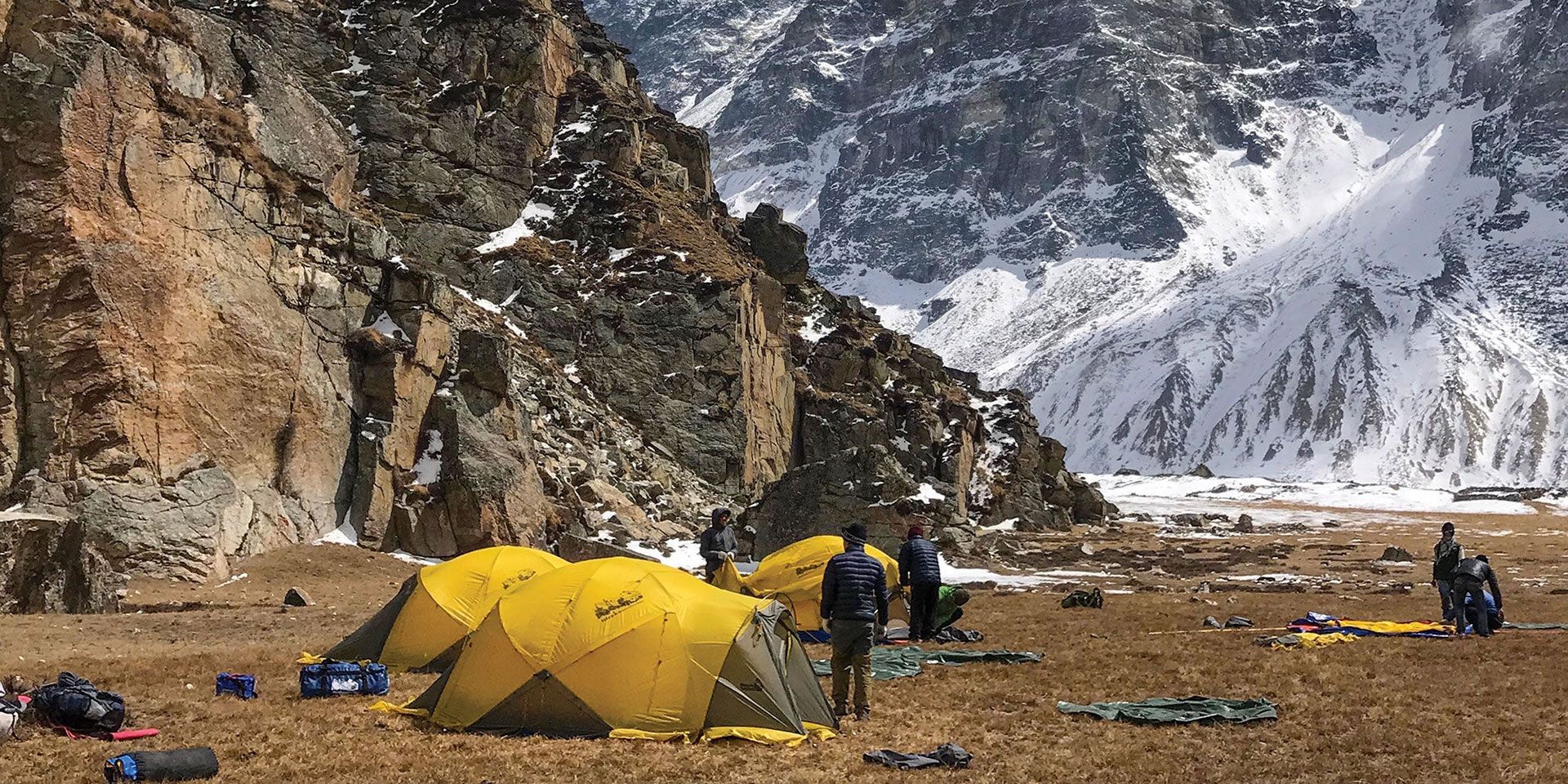
On a camping trek, you will carry and sleep in your own tent (it is possible to get a porter to carry your tent for you). You will also need to carry sleeping bags and food.
Starting and ending points: Kachenjunga on Nepal’s eastern border with India and Humla on its western border with Tibet
Total distance: 1,700 kilometers (1,056 miles)
Number of Sections: 10
Shortest Section: Langtang (18 days)
Longest Section: Makalu to Everest (34 days)
Time Required: Approximately 150 days for the entire GHT,
When to go: The best months for trekking are September to November and March to May
Difficulty: Challenging
Accommodations: teahouses - camping
Visit us
-
JP Marga, Thamel, Kathmandu, Nepal
-
+977-01-5365371
-
+977 98418-15039
(Whats App, Viber & Telegram)
